Viareggio, Italy (12 September 2024) – C-MAP®, a leader in digital marine cartography and cloud-based mapping, today unlocked uncharted waters by expanding coverage across inland France, UK and Ireland, as well as improved coastal bathymetry around Spain. These updates include extended inland coverage for Southern & Eastern France with another 58 lakes added, as well as improvements to over 7,000 bridges, shorelines, and almost 1,000 Locks.
“We are excited to roll out this new update to our C-MAP users in Europe, which will significantly transform their navigation experience,” said Jakob Svensson, C-MAP Product Manager. “This year, we have improved over 250 lakes in France alone with new bathymetry, providing great details in both contour and Shaded Relief layers.”
The new data improves the DISCOVER™, REVEAL™ and X Generation charts from C-MAP and is available as a free upgrade for anyone who has purchased and registered their chart in the past year. The new charts are now available, and you can view the latest charts for your location online at c-map.com/chartexplorer.
Updates for European Charts
- Improved Shaded Relief presentation for intertidal areas across the United Kingdom, Ireland, and Northern and Central Europe.
- Improved approximately 75% of France inland areas during 2024, with significantly more accurate shorelines, presentation improvements to almost 1,000 locks, and improved representation of over 7,000 bridges.
- Improved a further 58 lakes in France, totaling over 250 lake updates in 2024, and updates to 25 lakes across UK & Ireland.
- High Resolution Bathymetry & Shaded Relief improvements across coastal areas around UK and Spain, including the Canary Islands.
- Standard updates, including updated information on marinas and port plans, Notice to Mariners (NTMs), latest Electronic Navigational Charts (ENCs), and paper charts from official sources. Standard updates apply to all charts including Max, 4D, DISCOVER, REVEAL and X Gen charts within the EMEA portfolio.
The latest updates are available now in DISCOVER and REVEAL, as well as X charts, with Shaded Relief and Satellite Overlay only available in the REVEAL product tiers.
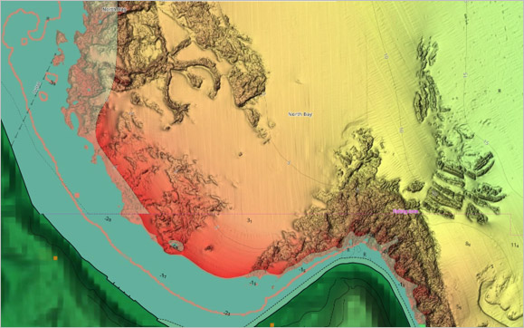
Improved shaded relief of North Bay, Scarborough
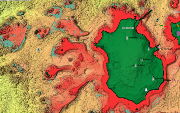
Improved shaded relief in intertidal areas
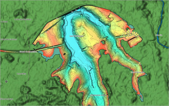
Lac d'Amace – high-resolution bathymetry
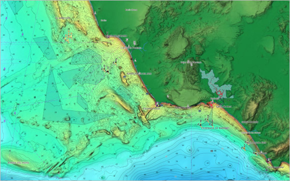
Costa de la Luz, Spain – high-resolution bathymetry
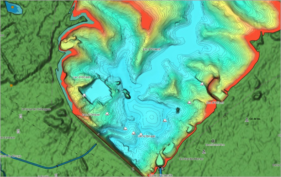
Lac d'Orient, France – high-resolution bathymetry
About Navico Group
A division of Brunswick Corporation (NYSE: BC), Navico Group is the world’s leading supplier of integrated systems and products to industries ranging from marine to recreational vehicle and beyond. The Navico Group portfolio is comprised of industry-leading brands in power management, digital control & monitoring, networked devices, and marine electronics. Some of the many brands that make up Navico Group include: Ancor, Attwood, B&G, BEP, Blue Sea Systems, C-Map, CZone, Lenco, Lowrance, Marinco, Mastervolt, MotorGuide, Progressive Industries, ProMariner, RELiON, Simrad, and Whale.


